Great Rivers Greenway Plans North Riverfront Trail Repairs
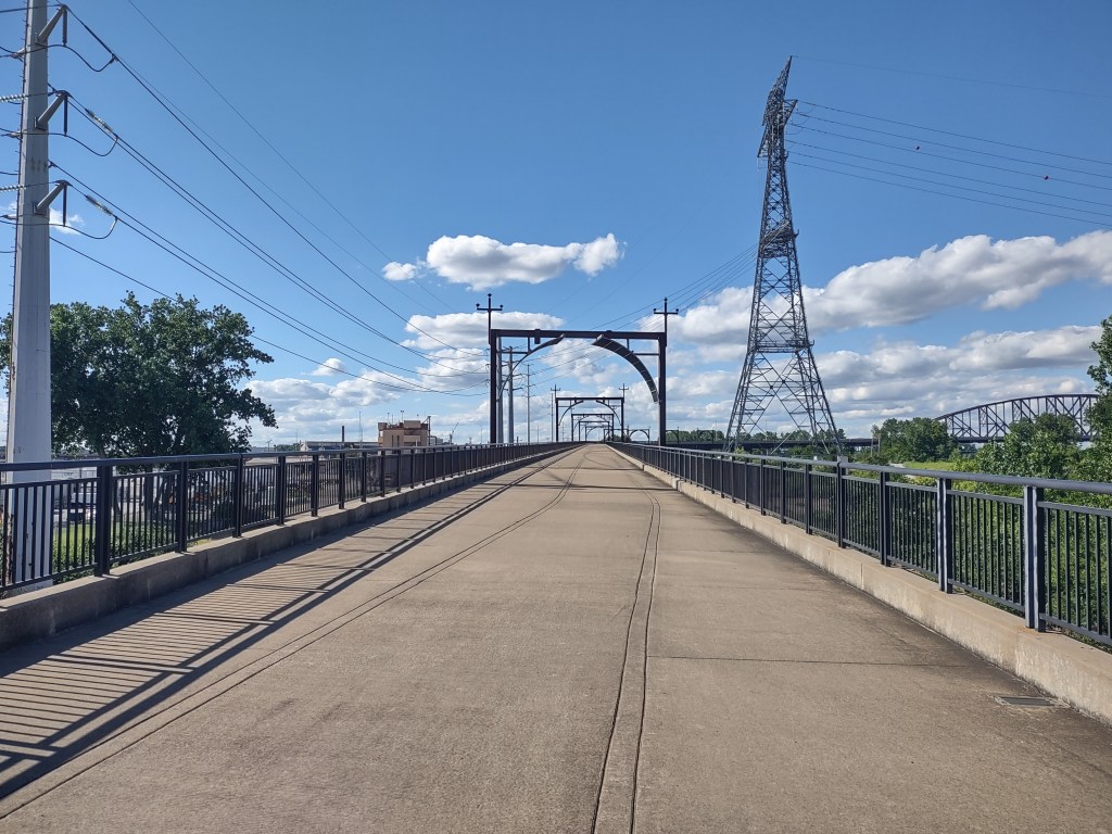
Bicyclists and pedestrians enjoy their time on the North Riverfront Trail, which is maintained by Great Rivers Greenway (GRG). The path runs from the northern end of the Gateway National Arch park along the river to the Chain of Rocks Bridge. The trail was largely fashioned from a service road that was converted for non-motorized use. Trail users see much of the industrialized riverfront that is hidden from drivers, along with scenic river views and a surprising amount of wildlife. It is not uncommon to see deer and turkeys along the trail. The trail also connects to the bike path that runs along the southern side of the McKinley Bridge. This allows both commuters to access jobs on the opposite side of the river and gives Missouri’s recreational cyclists access to Madison County Transit (MCT)’s impressive network of protected bike paths in Illinois.
Given its location at the northern end of the riverfront park, the trail is also well positioned to be an amenity highlighted by the city’s nascent push to increase investment in the downtown riverfront. The Spencer administration has made a public case that the city should invest Rams settlement money into the riverfront. City leaders have proposed a new dock and other improvements to the riverfront. This would bring significant new investment to the North Riverfront Trail’s doorstep.
Northern Entrance Closed for Years
Unfortunately, the gate separating the riverfront park from the trail has been closed for numerous years, forcing cyclists to use Martin Luther King Jr Blvd as a detour. This involves a steep climb up to N 1st St, which runs past the Hotel Lumiere and the Horseshoe Casino. Some cyclists choose to use Commercial St, though the gates are generally closed and the condition of the street is heavily deteriorated. Ivan Martin, a cyclist for over 50 years, uses Commercial St and says, “I currently ride on Commercial Street to get around the flood wall, and certainly repaving of this ‘street’ could have been a viable alternative for cyclists.“ At the end of this block, cyclists must navigate an extremely steep drop back down Carr St to the level of the riverfront trail. Here, one is greeted by the curious sight of a newer gate system that seems to have sat unused. As one turns north, they pass the Ashley Energy plant, the Bob Cassily-designed Rootwad Park, and the William A Kerr Foundation’s performance space. Going north from there takes riders into the most industrialized portion of the trail. Commenting on the ongoing northern gate closure, Martin said, “I have found this matter most frustrating on many levels since the closing has appeared permanent for the past 5 years. The most frustrating aspect, despite ease of access, is the lack of any detour signage, except during the River to River Century Ride.”
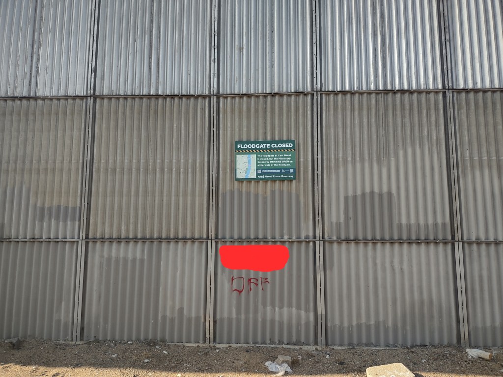
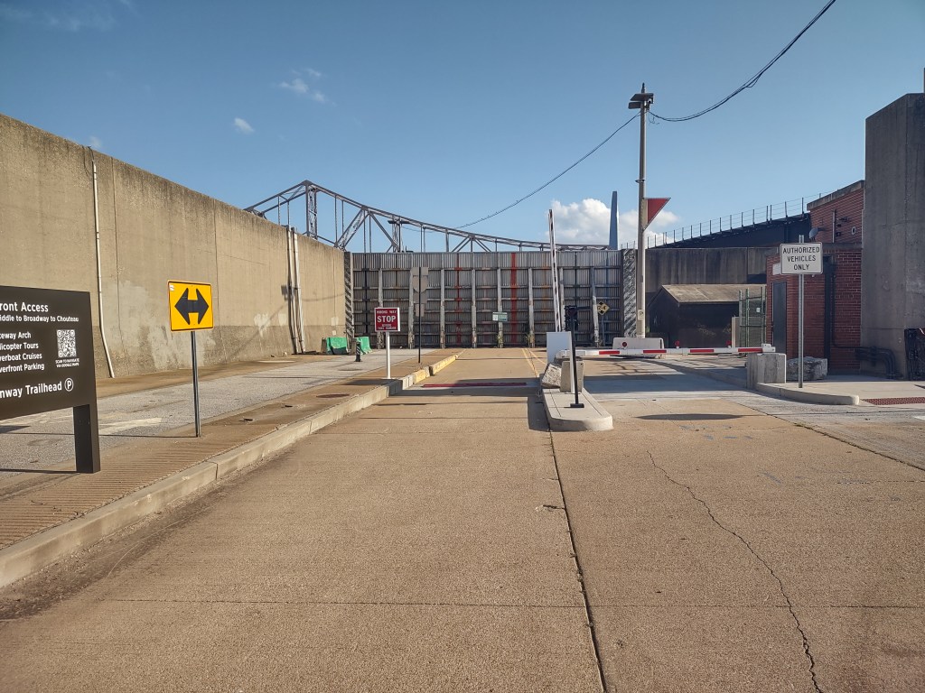
The southern flood wall gate remains open, giving access to the park from one end. Here, a gate system slows traffic into the riverfront, though recent visits have featured damage to the system that appears to have forced the city to leave the gates raised throughout the day.
For their part, GRG’s Vice President of Communications & Outreach Emma Klues says that they are working on reopening the northern gate. “The City closed the Carr St flood gate years ago (during COVID) due to dangerous car racing that was happening along the riverfront. We’ve long advocated for reopening the gates, and the City agreed to do so if we worked on installing a different access control system (the new gates). Those have been built, but the electrical wiring has gotten stolen twice in the last year, so even though the bulk of the construction has been done for a while, we’ve never gotten it to the point of turning it on because the theft and re-ordering and installing takes time. Not wanting to waste any more money on the same approach, we worked with the City on a different solution, and they have found additional funds to secure the wiring better. They have hired a contractor, but they’re waiting for Ameren to install the meters so they can re-install the wiring yet again,” stated Klues. As previously noted, the gates at the southern flood wall entrance have also been damaged. The southern end of the park has not been closed, despite the traffic gates being nonfunctional during recent visits.
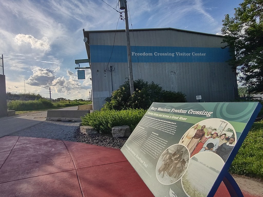
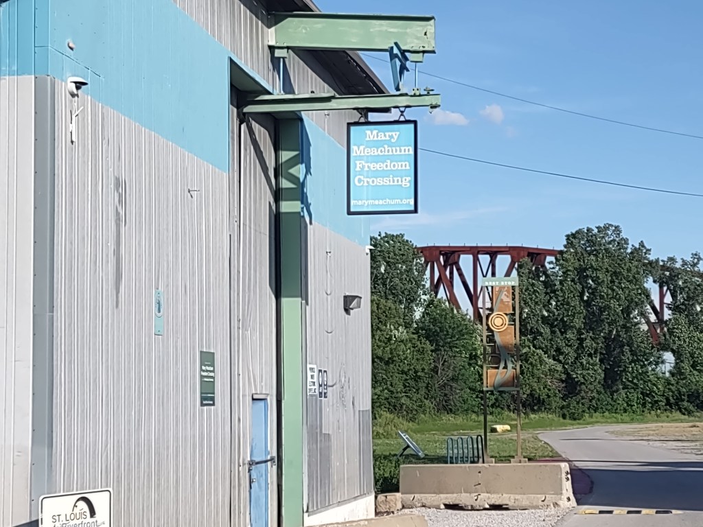
Trail Features Black History and Crumbling Pavement
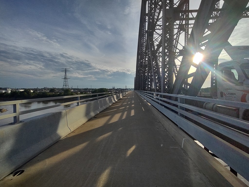
As one leaves the downtown area, they navigate past an offshoot that takes riders across the McKinley Bridge and into Illinois. From there, cyclists are able to access MCT’s trails, taking them northward towards the Chain of Rocks Bridge or to Alton, IL. If riders continue northward along the Missouri side, they will soon come upon the Mary Meachum Freedom Crossing site, commemorating local efforts by enslaved people to escape across the river to IL, a “free” state. It is a poignant and important piece of local Black history. Throughout this journey north of downtown, riders see the industrialization of the riverfront, with factories, railroad tracks, and service roads interconnecting in a web. While the industrial nature of the riverfront is never far out of view, it is juxtaposed with nature and wildlife. Riders will commonly see vehicles parked off the service roads, while their drivers sit on the bank fishing. Some spots are more popular than others, and it is apparent that certain areas have “regulars” that come to spend time with friends. There are portions of the trail where riders often see deer and other wildlife. Riders will also see trash, lots of it. Along the trail, there are numerous spots that are accessible via cars and trucks. In some areas that have less active business activity, riders see what appears to be illegal dumping activities. In these locations, discarded mattresses, furniture, and clothes have piled up. GRG states that they monitor the trail and remove illegally dumped items on a regular basis.
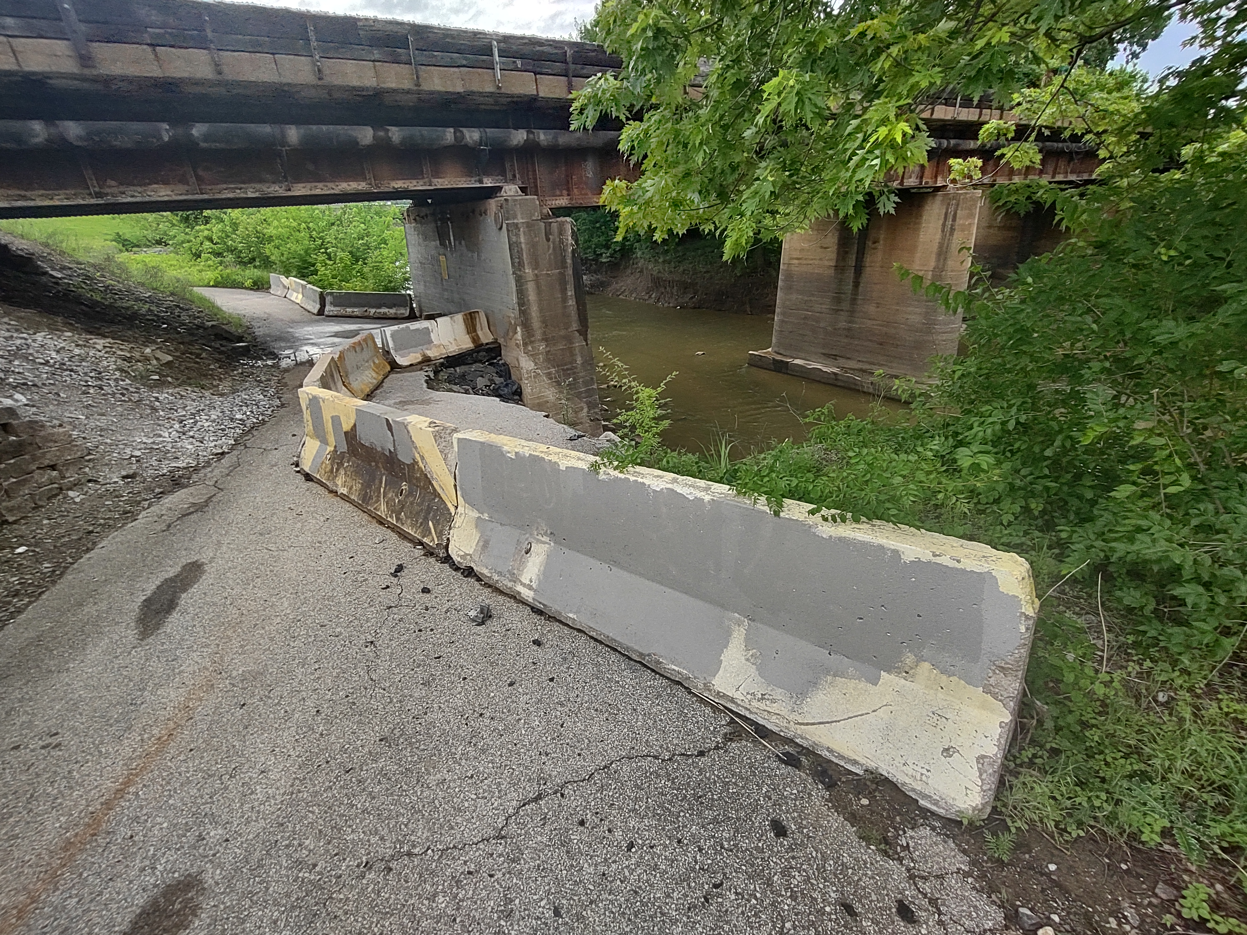
As one continues on the journey toward Chain of Rocks, riders are greeted by an issue that threatens to close the trail: flooding has clearly caused much of the bike/pedestrian lane to collapse. Concrete traffic barriers encourage trail users to stick to a narrow strip of pavement that remains safe, though there does not appear to be any precautionary signage warning cyclists about the missing pavement. If one looks closely, they can clearly see that erosion has continued under the remaining pavement. Eventually, it is likely that the remaining trail section will crumble and fall down the hillside. GRG’s Klues offered the following explanation for why the path hasn’t been repaired, despite the portion of the trail having been this way for quite some time. “This one is also close to a solution after a frustrating delay. After a major flood washout, as your photos show, we again worked with the City of St. Louis to figure out a solution, go through the re-design/engineering process, apply for permitting to do the work, etc. This required permission from the BNSF Railroad because it’s partially on their property, and despite diligent persistence from our staff, it took them more than 2 years to agree to a solution and subsequently sign the paperwork,” stated Klues over email. She also stated that GRG has just opened the work to bid, and they hope work begins in August and is completed by the end of 2026.
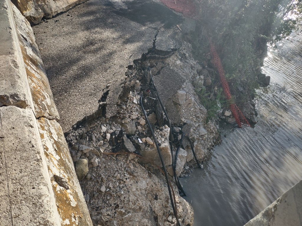
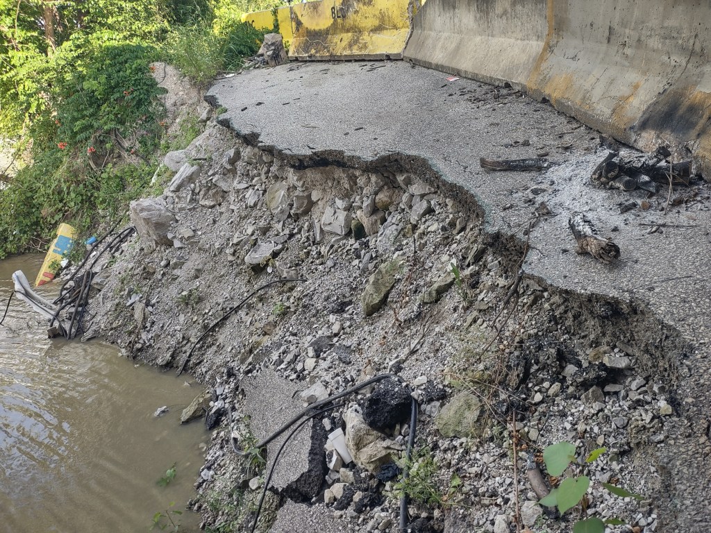
If the trail did fully collapse, this would mean that the trail would effectively close, stopping users from completing their journeys north to Chain of Rocks or south to the Arch grounds. It would also stop users who are going downtown from Illinois using this path, forcing them to use the McKinley Bridge path as an alternative. While the bike path on the McKinley Bridge offers wonderful views, it is not maintained to the same level as the Chain of Rocks Bridge, which serves as an exclusively pedestrian/cyclist bridge across the river and is closed to motorized traffic. The bike lanes along the McKinley Bridge are often filled with broken glass from bottles that have been thrown from passing vehicles in the motorized traffic lanes, while Chain of Rocks remains largely without trash and items that could puncture tires. “The long access ramp to the bike crossing is well maintained with nice plantings… quite pleasant. Once turning east onto the bridge, the scenario changes dramatically, and it is a change that matters dearly to a cyclist…there is debris and glass everywhere…has been like this since I started riding over this segment for almost a decade and a half. Over the past year, on a segment on the Illinois side, fencing was installed, and the problem was solved. Surely this fix could be applied to the Missouri side,” suggested Martin.
As far as planned upgrades to the trail, GRG does not have anything in the works. “We have a lot of improvements identified, but nothing that is moving forward right now,” stated Klues. Klues pointed towards the complexities of the area’s industrial usage and mentioned more radical ideas like creating a whole new levee or other rerouting for the greenway. She did caution that such ideas would necessitate immense coordination between numerous public and private partners to undertake such a transformation.
St. Louis cyclists like Mr. Martin are looking forward to the promised reopening and rerouting of the trail. “Thanks to one and all for their tireless work to improve how we move on two wheels,” said Martin.
All photos in this article were taken by Glenn Burleigh


